2021 Prize Recipient
Xuezhu (Gillian) Zhao (MCP'22)
Witte-Sakamoto Family Prize in City and Regional Planning
Xuezhu (Gillian) Zhao, originally from Beijing China, is a Master of City Planning candidate concentrating in Smart Cities. Passionate about urban informatics and cultural heritage, she is enthusiastic about the possibility of leveraging data analytics to promote vibrant and sustainable communities, especially in the realm of economic development and transportation planning.
She recently worked as a Design Fellow for the Housing Initiative at Penn, looking at rental relief programs in Atlanta and Philadelphia during COVID-19. She currently serves as a research assistant in Professor Erick Guerra’s team, where she helps model the effect of the pandemic on SEPTA bus ridership. Prior to attending UPenn, Zhao graduated with highest honors from the University of Illinois at Urbana Champaign with a B.A. in Urban Studies and Planning and a minor in Informatics. She had also interned at the Champaign County Regional Planning Commission, where she prepared maps and analyzed data for planning applications.


-
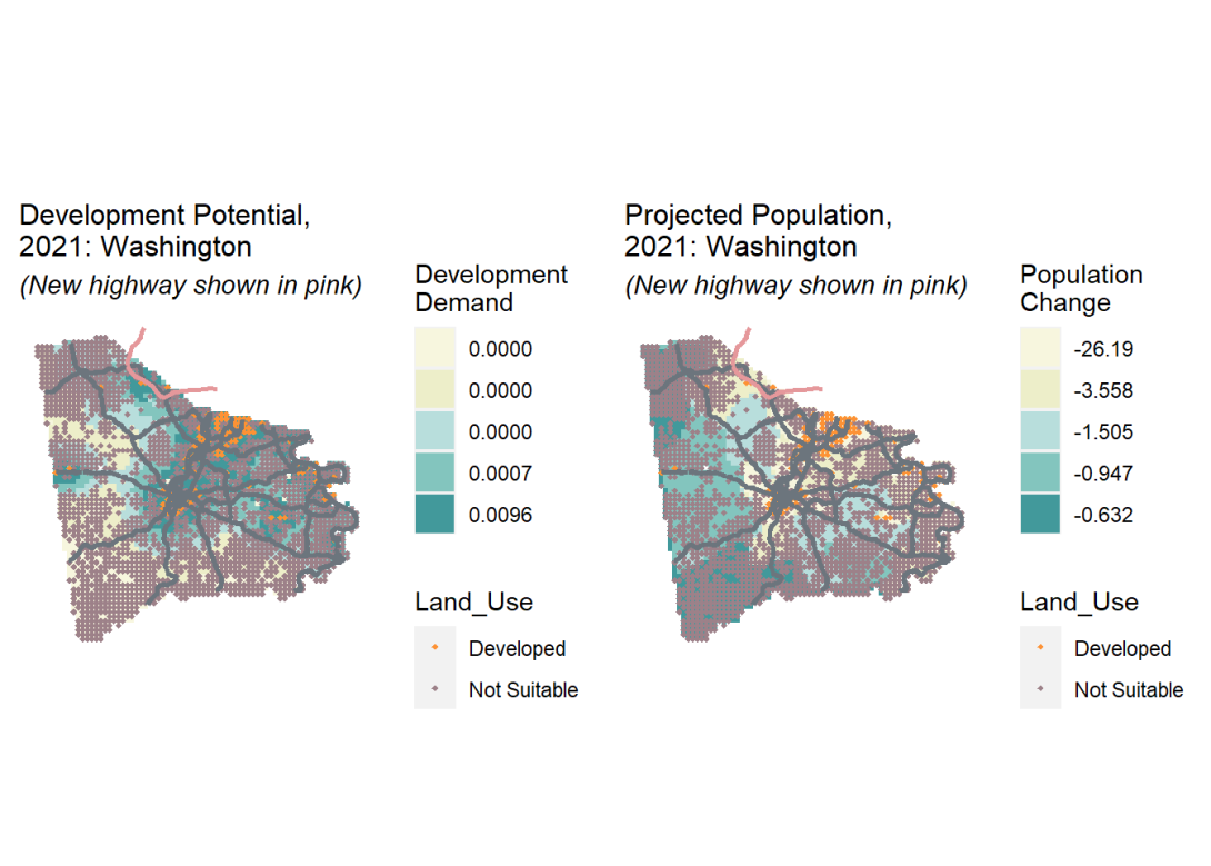 Through modeling the interplay between supply and demand as well as guiding economic and sustainable developments, smartness in planning can advance decision-making for urban growth. The maps are a part of a fictional growth modeling project which forecasts new development through a binary logistic regression model.
 -
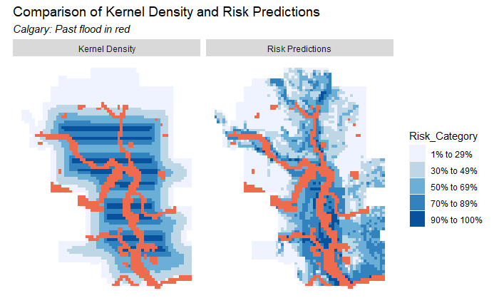 Data and analytics are key to risk and disaster management, as they can help inform designation of flood zones and allocation of prevention resources. This is a model that predicts the probability that an area will be inundated with flood water.
 -
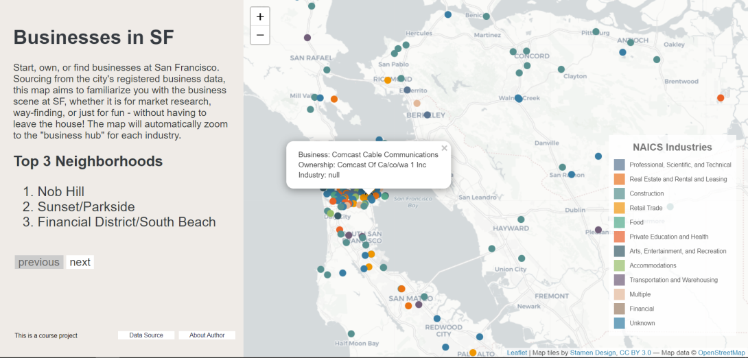 Open data and web mapping can be used to provide visual interpretation of otherwise abstract data. This interactive map helps familiarize users with the business scene at SF for different NAICS industries.
 -
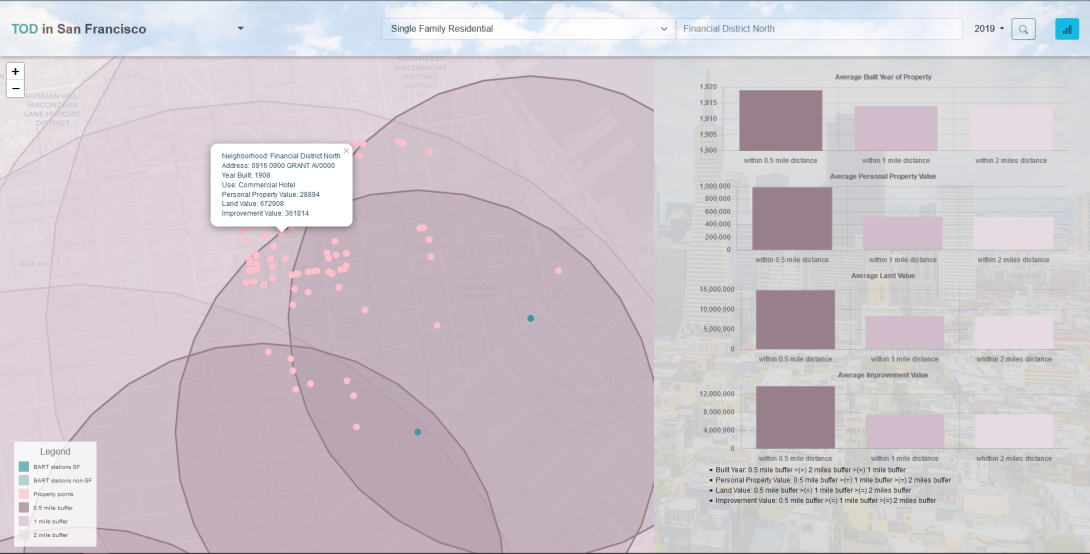 Transit Oriented Development (TOD) has been a trend that promotes more housing and mixed-use amenities near public transportation. Sourcing from the city’s property tax roll data and BART station data, my group built this online map to illustrate the economic impact of TOD in San Francisco over the past 12 years.